


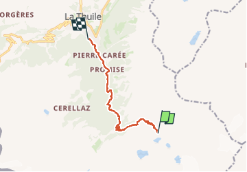
Rando AV 2 : Refuge Deffeyes – La Thuile

mpignon
User

Length
8.6 km

Max alt
2499 m

Uphill gradient
65 m
Km-Effort
12.8 km

Min alt
1476 m

Downhill gradient
1072 m
Boucle
No
Creation date :
2025-08-11 05:13:04.369
Updated on :
2025-08-14 12:49:00.55
2h45
Difficulty : Difficult

FREE GPS app for hiking
 SityTrail
IGN / Geographical institutes
SityTrail Plus
The world is yours!
About
Trail Walking of 8.6 km to be discovered at Aosta Valley, Unknown, La Thuile. This trail is proposed by mpignon.
Positioning
Country:
Italy
Region :
Aosta Valley
Department/Province :
Unknown
Municipality :
La Thuile
Location:
Unknown
Start:(Dec)
Start:(UTM)
343146 ; 5059959 (32T) N.
Comments